Urban planning
19th century travelers to Cairo often complained about the winding, confused arrangement of streets in the old city. Egypt’s pasha, Ismail (r. 1863-1879), attempted to redesign Cairo in the fashion of European cities, with broad straight boulevards. You can still see both Cairos today: Ismail’s boulevards and the alleyways of the old city.
Neighborhoods and districts of ancient villages, towns, and cities are somewhere between town planning and self-organization. As settlements grow, there is often little planning on where the next house gets built with respect to an overall design.
People tend to build and expand according to local rules or kinship, trade, access to pathways, and other criteria. The larger pattern, like people settling in at a beach, is not chaos; it is a self-organized, complex order. There is an almost organic nature to this kind of rural development, even today.
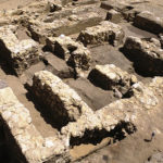
The streets of the Lost City are straight, clearly a departure from other ancient settlements. The broad streets divide large sets of galleries into great blocks according to an orthogonal design.
Lost City inhabitants could walk west to east on three streets:
- North Street
- Main Street
- South Street
These are broad streets by ancient standards, perhaps designed to accommodate a large volume of pedestrians moving together in and out of densely packed galleries.
North and Main streets are 10 ancient Egyptian cubits wide, about 5.2 meters (17 feet), while South Street was narrowed in antiquity when workers expanded a set of magazines.
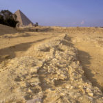
Main Street may be one of the oldest paved streets in the world. Our excavation squares showed that its builders laid down a bed of limestone and marl gravel. This, plus a paving of compact alluvial clay, resembled modern gravel bedding and asphalt pavement.
The three streets divide an area of about 185 meters (607 feet) north to south into four large blocks. We do not know the full extent of North Street but we have tracked Main Street for a length of 160 meters (525 feet) and South Street for 90 meter (295 feet).
While these streets allowed ancient workers a direct east-west crossing of the Gallery Complex, it appears there was only one major north-south route through the site. This route led south on a path starting at the open gateway in the wall, 35 meters (114.8 feet) west of where the settlement enclosure wall attached to the great Wall.
The path from the Wall of the Crow merges with a corridor that we call the Chute, which turns to the east, stopping about 15 meters (49.2 feet) from the West Gate, the opening to Main Street.
Inside West Gate, the villagers could move southeast along the enclosure wall on Wall Street, which curved with the Enclosure Wall to meet up with South Street.
No loitering
We are not certain if these streets were partially covered to provide shade from the blistering Egyptian sun.
Large structures (probably houses) stood at strategic points of entry into the streets. We think these might have functioned as check points and residences for administrators who controlled traffic in and out of the blocks of galleries.
The whole design—as far from self-organized as a settlement can be—speaks control. Authorities strictly controlled access to this settlement.
Movement in and out of the galleries, lined up comb-like along these broad streets, must have been regimented. Anyone coming out of the galleries and any movement down these broad lanes would be seen by those who watched from the Gate Houses. These were not streets where you would want to loiter on a hot day.
Separation and control
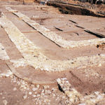
We found a curious feature in South Street where it meets the Royal Administrative Building on the southeastern end of the site. Sometime after the street was laid out, the inhabitants built a thick limestone Enclosure Wall, which jogs north and then east to get round the RAB, jutting into the eastern end of South Street.
Later still, builders made a curved mud-brick and fieldstone wall that narrowed this end of South Street to less than a meter. This bottleneck was much easier to guard than the previously broad street and afforded greater control over access to the Royal Building.
From here, two parallel streets ran along but on opposite sides, of the Enclosure Wall. The Enclosure Wall strictly separated those who traversed these two streets (South Street and RAB Street on the map).
Just where RAB Street rounds the corner of the RAB, you can see where, over the years, most people would naturally walk to the inside of the street, eventually wearing a depression next to the building.
Streets are one of those things that connect us to the Egyptians who inhabited this site 4,500 years ago. It is easy to imagine the life on these streets: walking, carrying water or supplies, visiting neighbors, and exiting the gates to walk to the pyramids. Movements we ourselves do every day on the site.


